IP Survey
23km 2D Induced Polarization (IP) and ground magnetic surveys (Figures 1-5) were completed by Simcoe Geoscience in 2018. IP data was acquired using “state of the art” ALPHA IPTM - a Wireless Time Domain Distributed Technology with ‘dipole-pole-dipole' configuration at 100 m station spacing.
The main objectives of this survey were to map chargeability and resistivity responses and magnetic highs and lows over the Backbone area and North West Cirque tourmaline breccia depression zone and associated copper porphyry mineralization at the Red Springs Cirque area to a depth of at least 800+ m.
An unprecedented survey was completed on profiles that were 3.5 to 4.0 km long in the steep mountainous environment, with rugged terrains covered with boulder fields and talus. Each profile was completed in a single deployment of up to 40 receiver dipoles and n 1-42, possible only with ALPHA IPTM and Simcoe’s experienced team.
The ALPHA IPTM survey identified at least 32 anomalous zones (Table 1) along 7 lines as significant targets to follow up from surface to ~800 m+ depths. Out of the 32 anomalous zones, 16 were considered first priority (S#), 14 second priority (W#) and 2 were third priority targets (P#). The survey also helped to understand tourmaline breccia mineralization zones do not exist in isolation; orogenically tourmaline is associated with porphyries and it has now been determined that these tourmaline breccia zones are distal to a large system of porphyries in the east (Red Spring Cirque). The porphyry target identification was made possible with ALPHA IPTM, geochemistry, structural and alteration mapping following outcrop rock sampling.
Table 1, Interpreted IP Anomalies Summary Table for Red Springs Project
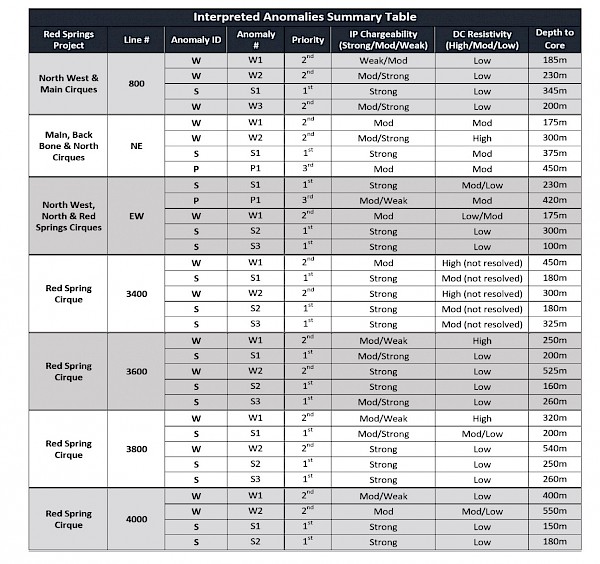
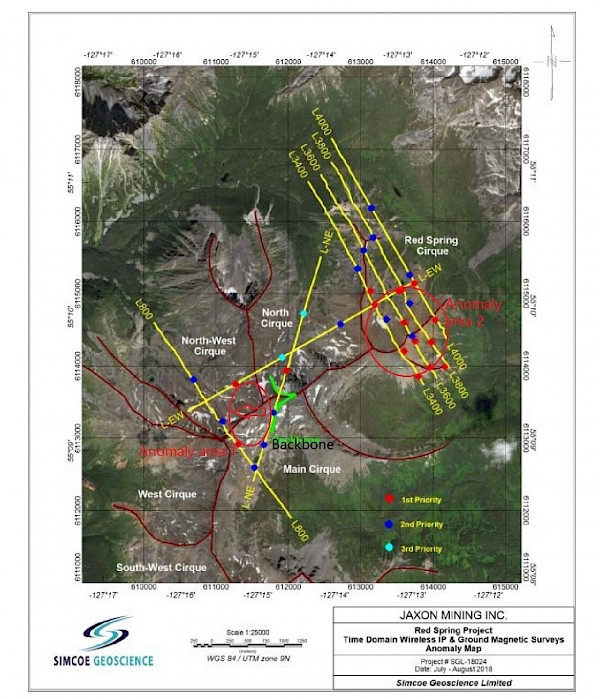
Figure 1, IP Survey Lines and Anomalies at Red Springs Project
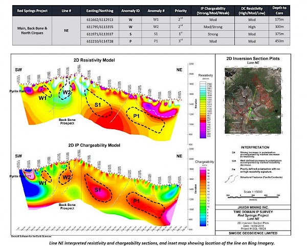
Figure 2, IP Anomalies along Line NE
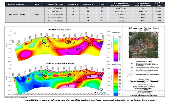
Figure 3, IP Anomalies along IP Line 3800
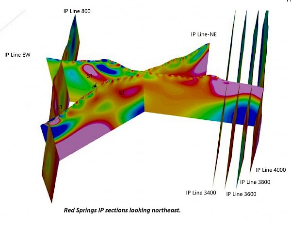
Figure 4, Red Springs IP Section Map Looking Northeast
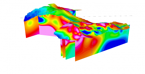
Figure 5, Red Springs Sections in 3D – Magnetic Anomaly Looking NW